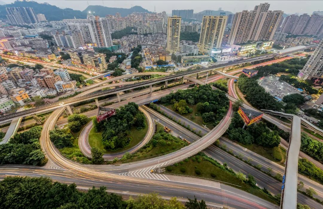
According to the Shenzhen planning and land development research center, on December 23, 2021, the Shenzhen trunk road network planning (2020-2035) was reviewed at the 27th executive meeting of the seventh session of the municipal government.
The planning objective is to guide the coordinated development of roads and rail transit, build an open, spatially balanced, intensive, efficient, green and low-carbon trunk road network, achieve the road accessibility goals of "10, 60 and 90" (i.e., 10 minutes to the high-speed road network, 60 minutes to the whole city, 90 minutes to the main cities in Dawan District), and support the smooth connection of Dawan District, the integration of the metropolitan area and the high-quality development of the whole city.
The plan closely follows the macro-guidance requirements for the development of national ecological civilization, the construction of the Guangdong-Hong Kong-Macao Greater Bay Area, and the transformation of the national land and space planning system, and proposes a hierarchical and differentiated road network construction path for the opening and interconnection of the bay area, the integration of metropolitan areas, and the management and control of urban scale.It reflects the overall development direction of Shenzhen Transportation's pursuit of structural transformation and space improvement and efficiency, and has a positive guiding significance for the construction of Shenzhen's trunk roads in the future.
The planning scheme is based on the existing planned road network, combined with regional and urban development needs, and takes the strategies of regional interconnection, urban balance and efficiency, and core area quality demonstration, and plans to form an "eight horizontal and thirteen vertical" high-speed road network system.The mileage is about 998 kilometers; the main trunk road is 955 kilometers.
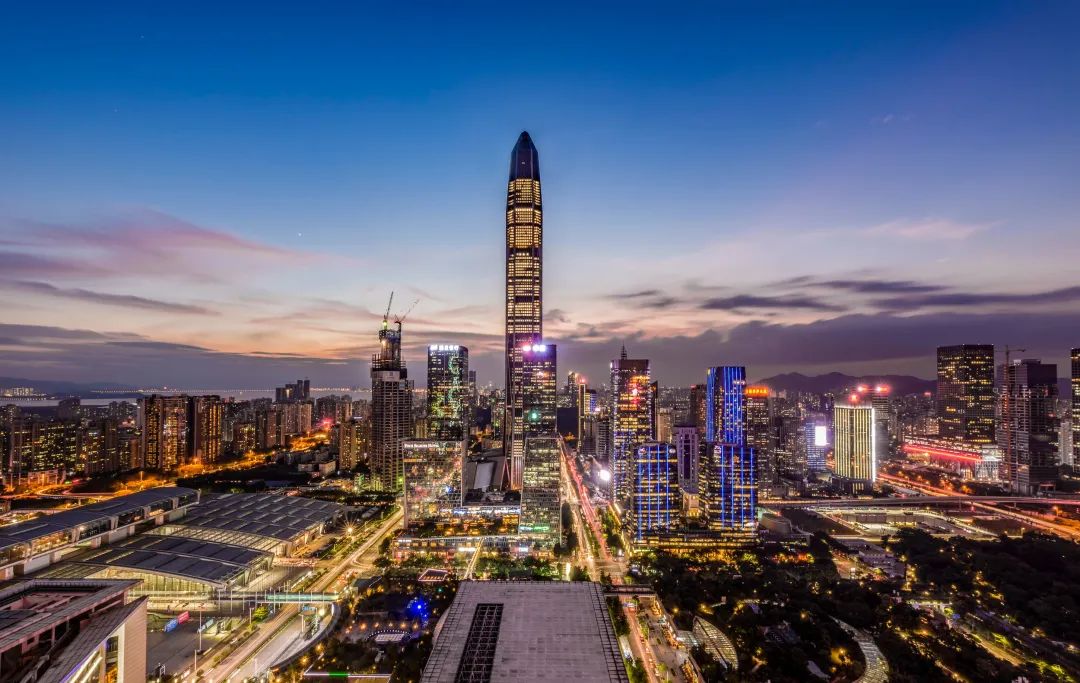
Join hands with cities in the Guangdong-Hong Kong-Macao Greater Bay Area to strengthen the interconnection of regional transportation facilities such as inter-city rail and expressways in the Bay Area, promote the efficient and convenient flow of development factors, and accelerate the rise of world-class urban agglomerations in the Guangdong-Hong Kong-Macao Greater Bay Area.
Facing the Bay Area, build a multi-directional open expressway network with east-west high-speed connection and north-south composite encryption. It is planned to add the Shenzhen-Pearl Corridor, the outer ring expressway extending westward and crossing the river, the second Shenzhen-Shantou expressway, the Shenzhen-Shantou cross-sea expressway, and the second Shenzhen-Huizhou expressway.For the expressway, the planning conditions for connecting Mawan Avenue to Hong Kong are reserved, forming an external channel layout with 3 cross-river routes in the west, 3 in the east, 7 in the north, and 4 in the south.
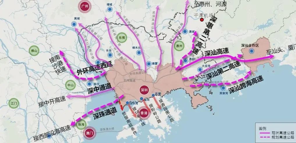
▲ Schematic diagram of Shenzhen-Bay Area expressway planning scheme
High standards will open up the expressway in the metropolitan area, and guide Shenzhen's industrial and functional radiation in an orderly manner.Binjiang Avenue, Nanguang Road, Longguan Expressway, Yanlong Avenue, Lvzi Avenue, Longpingyan Expressway are extended to the north, Danzi Avenue is extended to the east, and Yanbei Expressway is added, forming five expressways connecting Shenzhen to Dongguan and Huizhou..
Strengthen the connection, cooperation and co-construction of the trunk and trunk road networks in Shenzhen, Dongguan, and Huizhou, and promote the integrated development of border areas.
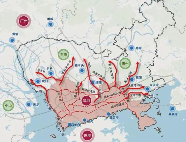
▲ Schematic diagram of the planning scheme of the expressway from Shenzhen to the metropolitan area
Facing the city's "one-core, multi-center networked" central system and the "1+7+N" global innovation space pattern, high-end elements in the central area of the city continued to accumulate, and the demand for east-west connections in the western corridor and peripheral urban areas increased significantly.Focus on densifying the expressway network in peripheral urban areas to form a city-wide expressway system with balanced layout and reasonable spacing, and plan to add new outer ring expressways, Xixiang-Danzi Avenue, Fuzhou Jihe Link Line, Luosha Road Expressway, etc.At the same time, optimize the connection between the core area and the external trunk lines, strengthen the connection between adjacent groups in the periphery, and support the positioning of key areas.
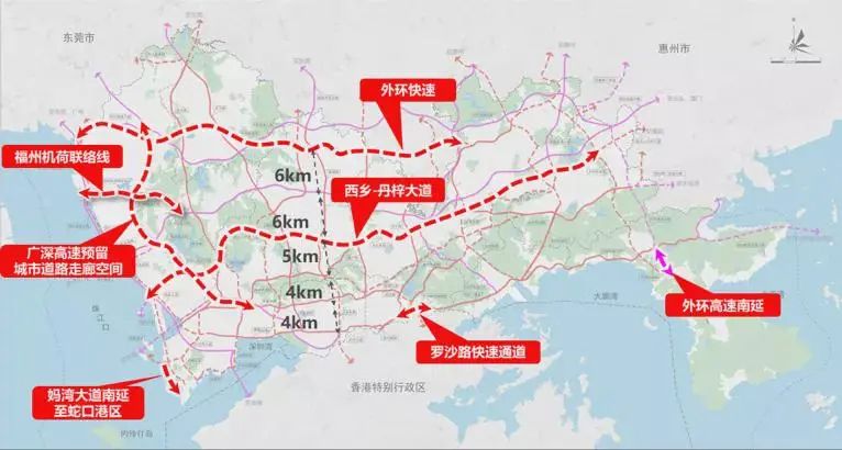
▲ Schematic diagram of urban expressway planning scheme
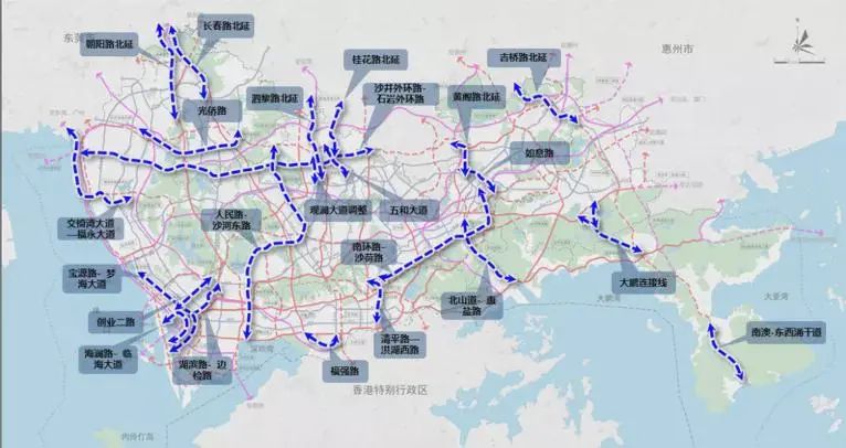
▲ Schematic diagram of the planning scheme of the main trunk road in the city area
Reshape the function of the main road network to support the expansion and improvement of the core area.Combined with the expansion needs of the urban core area, a new Xixiang-Danzi Avenue expressway connecting Baoan in the west to Longhua in the center and Longgang in Pingshan in the east is planned to be added in the northern part of the core area.Hai) Avenue together forms a rapid network in the urban core area.
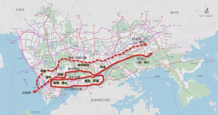
▲ Schematic diagram of the east-west expressway layout of "one ring and two horizontals" in the urban core area
The city's final plan is to form about 2,000 kilometers of arterial roads, which together with 2,000 kilometers of rail transit will form a modern comprehensive transportation facility system with complementary functions and spatial coordination, supporting the construction of Shenzhen's dual districts and the realization of the goal of becoming a demonstration city for a strong transportation country.
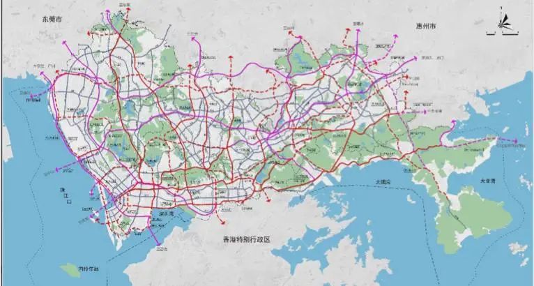
▲ Overall layout of "Shenzhen Trunk Road Network Planning (2020-2035)"
Traffic boosts urban development and opens up the urban pattern. The implementation of the "Shenzhen Trunk Road Network Planning (2020-2035)" will effectively guide Shenzhen's core urban industries to spill over to surrounding cities.
Huiyang, as the frontier of Huizhou's integration into the dual-zone construction and connecting the Guangzhou-Shenzhen-Hong Kong-Macao Science and Technology Innovation Corridor, is an important position for the city to build a "hundred-billion-dollar park, trillion-dollar industry" and build "feng" road traffic.
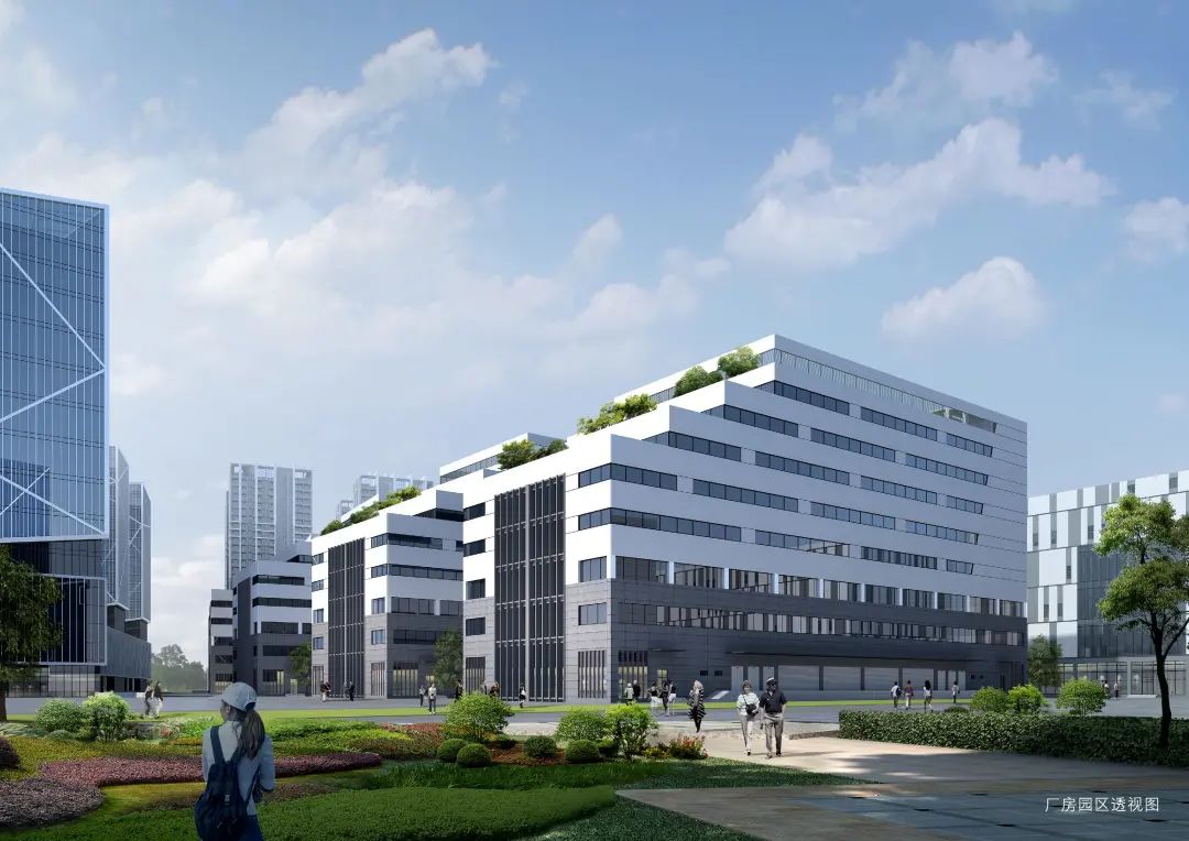
Meichuang Zhigu is located in Shenzhen East, Huiyang District, Yangna. It is located in the center of Huiyang industrial cluster and has a superior geographical location.
The project is located in the three-horizontal and one-vertical expressway network, with three horizontals running from east to west. From north to south, there are Chaoguan Expressway, Shenzhen-Shantou Expressway and Huishen Coastal Expressway, which are connected in series by Huida Expressway running north-south., which can quickly connect Shenzhen, Guangzhou, Shantou, Dongguan and other surrounding cities, and the high-speed access is very convenient.
It only takes 18 minutes for the project to reach Huizhou Port and 40 minutes to Pingtan Airport in Huiyang, which is positioned as the second airport in Shenzhen.The project is less than 2 kilometers away from the east exit of Danshui, and it only takes 5 minutes by car. From the east toll station of Danshui, it can reach all districts in Shenzhen via Shenhai Expressway.
It is a 10-minute drive from Huizhou South Railway Station. It is located on Metro Line 14, Xiamen-Shenzhen High-speed Railway and Shenzhen-Shantou High-speed Railway. It can easily realize the one-hour living circle of Shenzhen and Huizhou, and open the era of comprehensive integration of Shenzhen and the Bay.
Whether in terms of location, planning, or supporting facilities, Meichuang Zhigu is at the forefront of regional industrial parks.For the relocation of enterprises in the Greater Bay Area, Michuang Zhigu is the best choice!